#AfricaMonth
Trending
- Netflix reaches 40m users for ad supported planKarabo Ledwaba
Elections 2024
Advertise your job ad
Is your property registration and asset management causing headaches?
AfriGIS assists municipalities to enhance management and control of fixed assets.
Our Instant Online Smart City Solution enables you to:
- Map and manage your assets.
- Identify property portions and boundaries.
- Verify and validate addresses.
- Upload additional information layers, e.g. power lines, contours, construction, etc. in the area.
- See how a property changed over time by comparing this year and previous years' satellite imagery.
- Get full Cadastral and Deeds information.
- Communicate directly with your rate payers to their mobile phones.
- Confirm the location and increase the visibility of assets.
- Centralise fixed asset management.
- Improve regulatory compliance.
- Enhance governance and transparency.
How can we assist?
"Know what you own, and know why you own it." ~ Peter Lynch
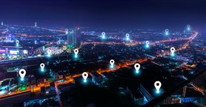
We create ONE OF A KIND GEOSPATIAL SOLUTIONS. We use geospatial information science to bring information about WHERE to life across industries and in any application. This helps our clients unlock value through better business intelligence.
- AfriGIS’s Peter Smythe appointed to GeoServer Project Steering Committee14 May 13:23
- Location intelligence is the secret weapon of data-driven banking13 Mar 15:56
- A GIS leap forward in the customer journey28 Feb 12:11
- What are you looking for?14 Feb 11:35
- Steering FMCG growth with GIS insights30 Jan 11:55